
In semi-arid regions of northern Tanzania, land degradation is not an abstract problem. It directly affects food security, livestock survival, and wildlife movement. What’s notable is not just that local pastoralist communities are involved in rangeland restoration, but how precisely they measure and manage it.
How Rangeland Health Is Measured on the Ground
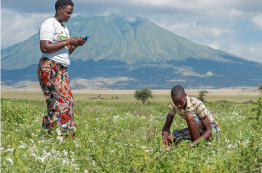
In Engaluka Village, rangeland monitoring is led by trained community members, not outside researchers. The process is deliberately simple, repeatable, and data-driven.
As rangeland monitor Nasma Mustafa explains, monitoring begins with basic tools: a measuring tape, a rope, and a mobile phone.
A rope is stretched along a 100-meter transect on the ground. Along that rope are five marked points. At each point, monitors record whether the mark touches live vegetation or bare soil. This process is repeated across targeted grazing areas until enough data is collected to represent overall land condition. The observations are logged directly into mobile phones and transmitted to the community grazing committee for review and action.
This method produces clear metrics: percentage of ground cover, vegetation recovery trends, and early warning signs of overgrazing. It replaces guesswork with repeatable evidence.
How the Data Changes Grazing Decisions
The data collected is not symbolic. It directly determines where livestock can and cannot graze.
Communities participating in the Sustainable Rangelands Initiative, developed by African People & Wildlife, use this monitoring data to implement rotational grazing and rangeland zoning. Areas showing declining vegetation cover are rested. Areas showing recovery are opened temporarily. Wildlife corridors are kept free of concentrated grazing pressure, maintaining movement routes for elephants, giraffes, lions, and plains antelope.
The ecological results are measurable. Monitoring has shown increased vegetation cover, reduced bare ground, and improved soil stability in managed zones. These improvements support both livestock forage quality and wildlife habitat, reducing conflict and pressure on nearby protected areas.
The economic outcomes follow the ecological ones. Healthier rangelands support larger, more resilient herds, reduce drought-related losses, and create conditions for conservation-linked income through employment and tourism partnerships. Communities benefit directly from maintaining land health, aligning conservation incentives with daily livelihoods.
Why This Matters Under Climate Stress
East Africa is experiencing more frequent droughts and unpredictable rainfall. In this context, unmanaged grazing accelerates rangeland collapse. What distinguishes this approach is not technology alone, but local control paired with measurable ecological limits.
By combining simple field monitoring with structured grazing decisions, pastoralist communities are restoring ecological function across working landscapes, not removing people from them.
Conservation Takeaway
Tanzania’s rangeland initiatives show that when communities directly monitor vegetation, adjust grazing pressure based on data, and protect wildlife corridors, rangelands recover, livestock systems stabilize, and biodiversity persists under increasing climate stress.