
Across the American West, wildlife managers are building something that barely existed a decade ago: a connected map of how big game animals actually move across modern landscapes.
In February 2025, the U.S. Geological Survey and state and tribal wildlife agencies released 36 newly mapped migration routes as part of the ongoing Ungulate Migrations of the Western United States project. The latest release brings the total number of documented migrations across the West to 218.
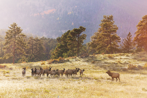
The effort spans multiple states and tribal lands, covering species including Elk, mule deer, and pronghorn. But this is not simply a research project. The maps are increasingly becoming a practical conservation tool used to guide land management, highway infrastructure, habitat restoration, and development planning across the region.
For decades, western wildlife management focused heavily on population numbers. Today, the conversation is shifting toward connectivity. Healthy herds still depend on the ability to move between seasonal ranges, often across hundreds of miles of public land, private ranches, highways, energy corridors, and expanding development.
That movement matters.
Elk and other migratory ungulates rely on seasonal transitions between high-elevation summer habitat and lower winter ranges where snow conditions are less severe. When migration corridors become fragmented by roads, fencing, subdivisions, or recreation pressure, animals are forced into narrower movement patterns that can increase mortality and reduce habitat efficiency over time.
According to the University of Wyoming-led Corridor Mapping Team, the mapping initiative is already influencing real-world conservation decisions. In Arizona, migration data helped redesign portions of wind and solar development to better accommodate wildlife movement. The data has also supported investments in wildlife overpasses and highway crossing infrastructure intended to reduce collisions and reconnect habitat.
The scale of the project is significant. Researchers now consider the western migration mapping effort one of the most comprehensive large-mammal movement databases in the world. The work combines GPS collar data, state wildlife agency partnerships, federal science teams, and tribal collaboration into a standardized mapping system designed for long-term conservation planning.
Importantly, the project also reflects a growing reality in North American conservation: habitat fragmentation is increasingly becoming the central challenge for big game management.
Many western herds remain stable today, but long-term conservation pressure is shifting toward maintaining functional landscapes capable of supporting migration itself. Wildlife crossings, intact winter range, fence modification, and coordinated land-use planning are becoming as important to conservation strategy as herd counts and harvest quotas.
For organizations like the Rocky Mountain Elk Foundation, the maps provide another layer of precision for identifying where conservation dollars and habitat work can have the greatest impact.
The future of western big game conservation may depend less on restoring populations and more on maintaining the landscapes that still allow migration to function at scale.
That work is now being mapped in real time.
Conservation Takeaway
Healthy elk herds still depend on healthy movement. Across the West, migration corridors are becoming just as important to conservation as population numbers themselves.