
For decades, mule deer management across much of the American West has relied on boundaries drawn generations ago. In Oregon, many of those Wildlife Management Units (WMUs) date back to the 1950s, long before GPS collars, migration mapping, and modern habitat science fundamentally changed how biologists understand mule deer movement.
Now, Oregon Department of Fish and Wildlife (ODFW) officials are beginning to shift away from managing mule deer according to lines on a map and toward managing deer according to how the animals actually behave on the landscape.
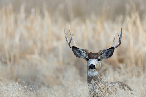
The change comes after years of GPS collar research involving more than 1,400 mule deer across Eastern Oregon. What biologists found was significant: mule deer herds routinely crossed traditional management boundaries, migrated farther than expected, and relied heavily on seasonal habitats that existing hunting and management frameworks did not fully account for.
Instead of continuing to manage mule deer solely through older WMU structures, Oregon is now incorporating “herd ranges” and migration-based data into long-term conservation planning and hunting management.
That may sound technical, but the implications are substantial.
Across the West, mule deer populations continue facing pressure from habitat fragmentation, wildfire, invasive grasses, drought, development, and changing winter conditions. At the same time, researchers are increasingly emphasizing the importance of migration corridors and seasonal habitat connectivity to herd survival.
A mule deer herd is not simply tied to one location. Deer may summer in high-elevation forest, migrate dozens of miles through bottlenecks and private land, and spend winter concentrated on low-elevation range critical for survival. If one piece of that system breaks down, the entire herd can suffer.
Traditional management boundaries often fail to reflect those realities.
ODFW’s evolving approach reflects a broader trend emerging across western wildlife management agencies: the growing recognition that modern mule deer conservation must become more data-driven, migration-focused, and habitat-centered.
The issue is not simply harvest numbers. It is whether the landscapes mule deer depend on remain connected and functional.
That includes:
- protecting winter range
- identifying migration bottlenecks
- reducing habitat fragmentation
- understanding post-fire vegetation changes
- improving mapping of actual herd movement
The Oregon effort also highlights how modern wildlife science is reshaping conservation policy in real time. GPS collar data now allows managers to identify specific corridors, stopover habitats, and seasonal movement patterns with remarkable precision.
In many ways, the old system managed deer according to administrative convenience. The newer system attempts to manage deer according to biological reality.
That distinction matters.
As western states continue grappling with mule deer declines, Oregon’s migration-focused management model may become increasingly influential. Similar conversations are already occurring in Wyoming, Colorado, Utah, Idaho, and Nevada, where agencies are investing heavily in migration mapping and habitat connectivity projects.
For hunters, landowners, and conservationists alike, the shift represents something larger than a regulatory adjustment. It reflects a growing understanding that successful mule deer conservation depends less on static boundaries and more on protecting the full landscapes deer actually use throughout the year.
Conservation Takeaway
GPS collar science is showing that mule deer depend on connected seasonal habitats, healthy winter range, and intact migration corridors to survive. As development, wildfire, fencing, and habitat fragmentation continue reshaping the West, wildlife agencies managing deer according to real-world movement patterns may be better positioned to conserve healthy herds long term.